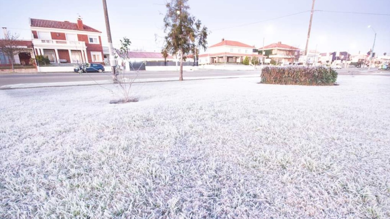

Heavy frosts (photo) will be common this week in Uruguay, but isolated parts of the country could see snow or aguanieve between today and tomorrow | Andrés Cubillo/Agrocasting Uruguay
Conditions between today and tomorrow will be favorable for winter rain in Uruguay with the possibility of snow, snow and rain mixed with snow (aguanieve), according to MetSul Meteorologia's forecast.
A very cold air mass covers Uruguay at the beginning of the week and is gaining strength with exceptionally cold weather, especially from the center to the south of Uruguay.
Model numbers analyzed by MetSul Meteorologia indicate temperatures at the 850 hPa level (1,500 m altitude) over Uruguay of -7°C to -8°C early this week, indicating a very cold air mass.
It is not at all common to see such low pressure levels in the latitudes of Uruguay, where cold air masses like the current one are more frequent in the south of the continent, in the Patagonia region.
With the weather as cold as expected at the beginning of the week, it will be very cold in the first half of the week in Uruguay with a very low minimum during the early morning and very cold in the afternoon even with the sun.
The circulation of moisture from the sea with the formation of vertical clouds combined with very cold weather could lead to wintry rain on Monday and into Tuesday in Uruguay.
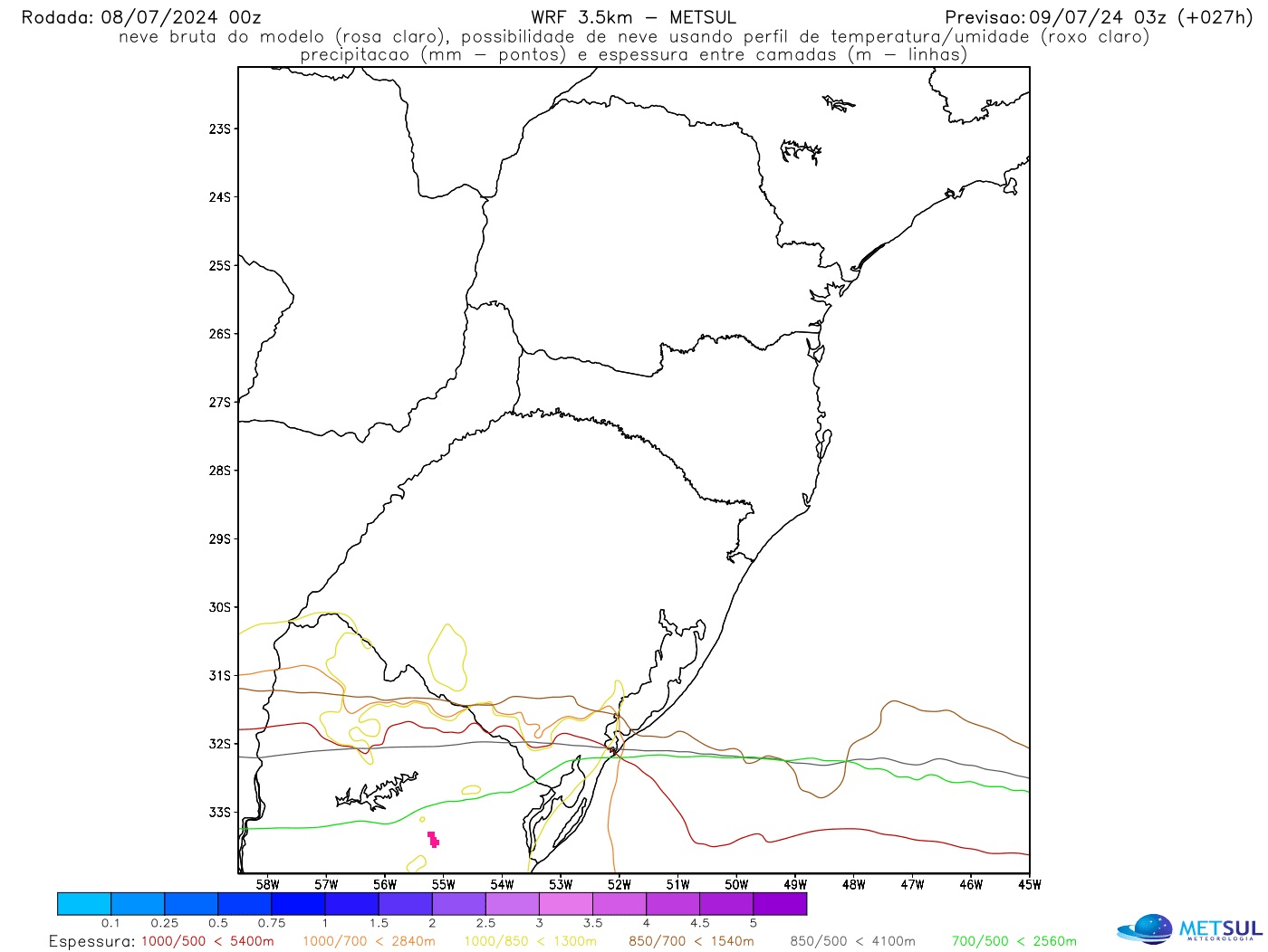
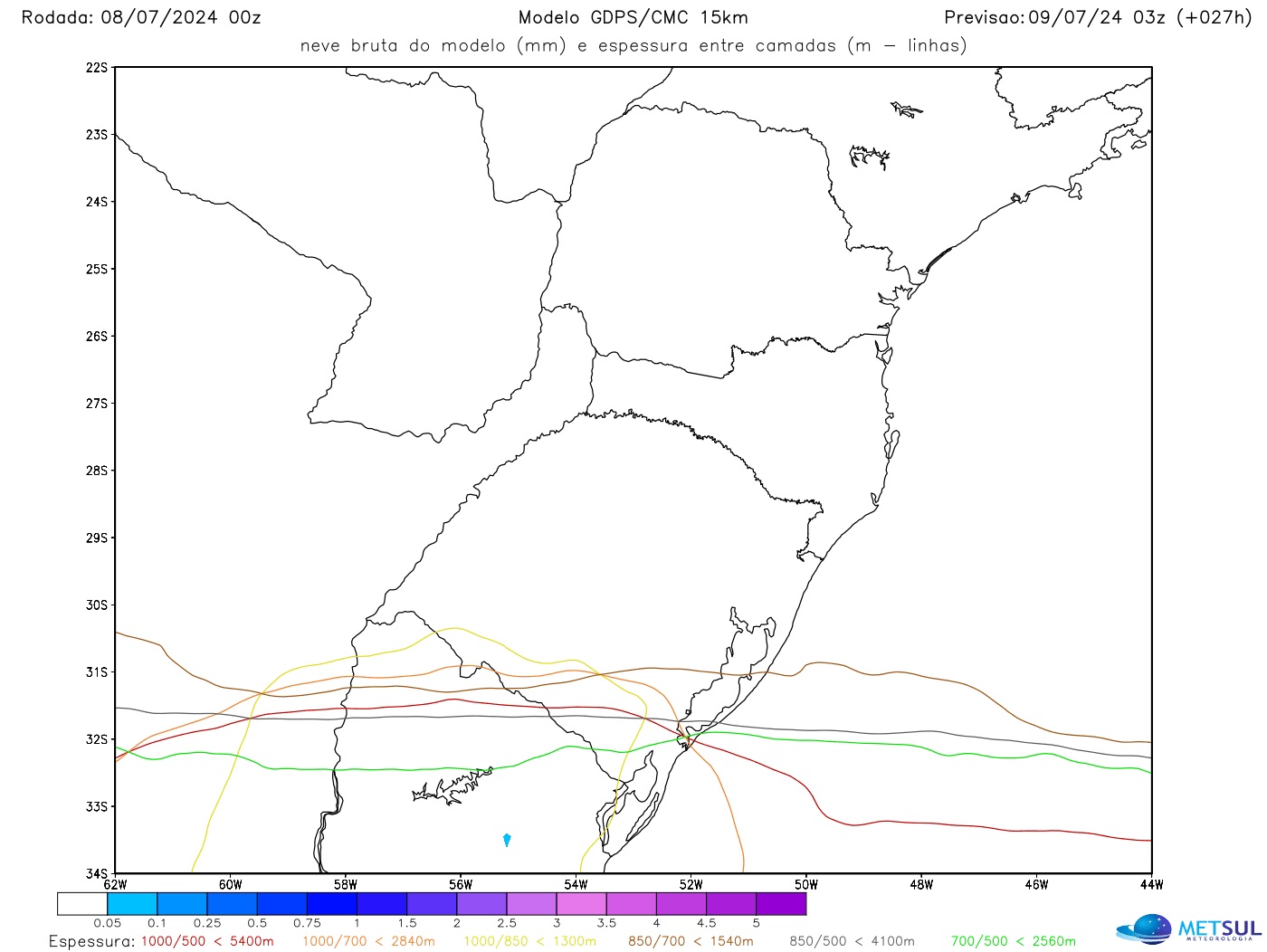
The snow range maps below from WRF and Canadian models indicate the potential for isolated, temporary snowfall in parts of central and southern Uruguay, especially between the end of today and the beginning of Tuesday.
With this, MetSul expects the possibility of winter precipitation phenomena such as snow pellets, snow and rain mixed with snow (aguanieve) in parts of Uruguay, especially in the central and southern part of the country, at the beginning of the week.
Early Tuesday will be freezing in Uruguay with a very cold morning. Almost the entire country will experience temperatures below zero and in some provinces the minimum temperatures could drop to between -4°C and -6°C with strong to severe frost.
The cold will remain very intense throughout the week in Uruguay, causing repeated days of sub-zero temperatures and lots of frost. The cold will not begin to ease until a greater rise in temperature after the 15th day.
MetSul Meteorologia is on WhatsApp channels. Subscribe here To access the channel in the messaging application and receive forecasts, alerts and information on the most important weather and climate events in Brazil and around the world, with exclusive data and information from our team of meteorologists.

“Proud explorer. Freelance social media expert. Problem solver. Gamer.”

